Thermal Imaging Camera Drone: What Homeowners Need to Know
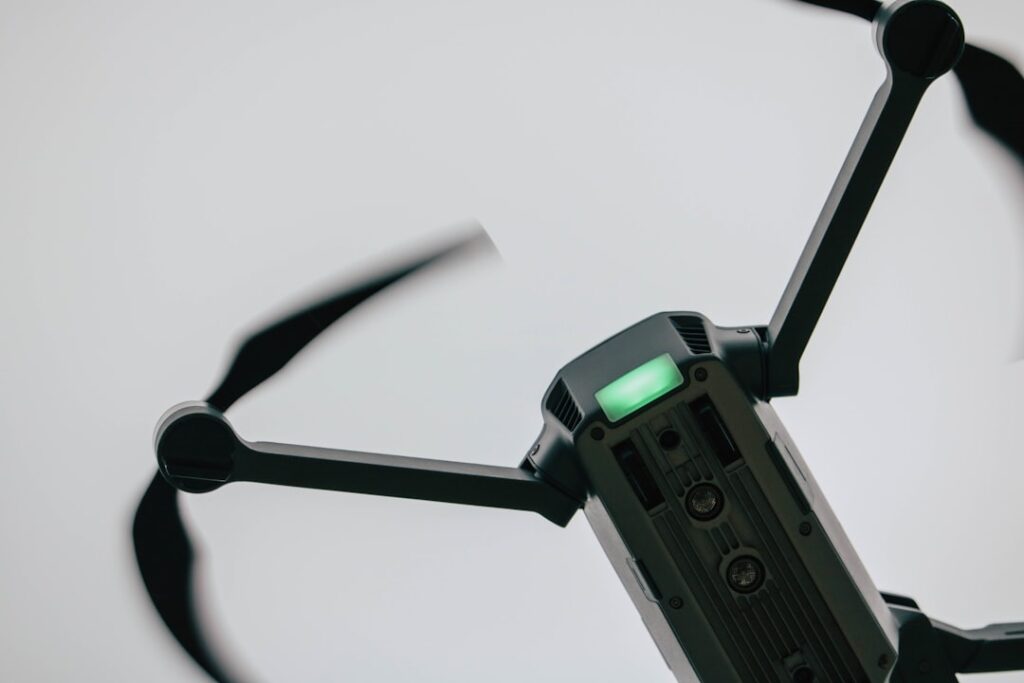
“Thermal imaging camera drone” emphasizes the camera-and-flight-platform integration: a calibrated thermal sensor mounted on a stable gimbal, on a drone capable of holding position long enough to capture useful imagery. This guide covers what that integration actually looks like in 2026, how the thermal sensor and visible-spectrum camera produce fused imagery, the image-fusion workflow inspectors use to interpret results, and the operational considerations that distinguish a useful tool from an expensive toy. The frame is residential and small-commercial inspection use — not industrial infrastructure, not film production, not search and rescue.
What an integrated thermal-camera drone actually is
Three components combine into the working tool:
The flight platform
The drone itself — frame, motors, battery, flight controller, communication link to the operator’s controller. Stability, wind tolerance, flight time, and payload capacity matter. Inspection-grade platforms in 2026 typically offer 30-55 minute flight times, wind tolerance of 10-15 meters per second, and stable hover within a meter for the duration of imagery capture.
The thermal sensor
An uncooled microbolometer array sensitive to long-wave infrared (typically 7.5-13.5 micrometers). Resolution ranges from 160×120 at entry tier to 1280×1024+ at high end. The sensor is calibrated at manufacture and recalibrated periodically through field shutters that re-establish reference temperature.
The visible-spectrum camera
A standard RGB camera, usually with a wide-angle or moderately telephoto lens, capturing standard color photography simultaneously with the thermal sensor. Resolution typically 12-48 megapixels on inspection-grade platforms.
The combination produces two synchronized image streams from the same gimbal position, which can be displayed separately, side by side, or fused into a single image showing thermal overlay on visible-spectrum context. Image fusion is what differentiates current generation tools from earlier thermal-only drones.
Image fusion: what it does and why it matters
Thermal imagery alone is often hard to interpret. A patch of warmer-than-surrounding pixels on a roof could be wet insulation, an HVAC exhaust, a vent, a chimney, or solar reflection. Without spatial context, the operator cannot tell. Image fusion solves this by overlaying the thermal data onto the visible-spectrum image, so the operator sees the building features (vent locations, equipment, roof penetrations) at the same time as the thermal pattern.
Picture-in-picture fusion
Thermal image appears as a small inset on the visible-spectrum image. Useful for orientation but limits the thermal detail visible.
Overlay fusion
Thermal data is rendered as a partially transparent overlay on the visible image. The operator sees building features and thermal patterns together. Most useful for inspection interpretation.
Side-by-side
Both images displayed at full size next to each other. Operator visually correlates between them. Useful for documentation reports and detailed analysis.
Radiometric capture
Beyond display fusion, professional-tier platforms record radiometric JPEG files that store actual temperature data for every pixel. Post-flight analysis software can re-process the file with different palettes, spot-temperature measurements at specific points, and area statistics. The radiometric capability significantly expands what can be done in the report-writing phase versus what is visible in real time during flight.
The integration that distinguishes inspection drones from hobby drones
Several integration details separate purpose-built inspection drones from hobby drones with added thermal modules.
Gimbal stability
Thermal sensors have lower resolution than visible cameras and rely on stable image capture for interpretation. Three-axis gimbal stabilization within a fraction of a degree is standard on inspection platforms. Vibration produces blurred thermal images at typical inspection distances.
Synchronized capture
Thermal and visible cameras capture simultaneously from the same gimbal, so the images align for fusion. Hobby-grade thermal modules attached to drones often capture independently, requiring manual alignment in post-processing.
Radiometric data storage
Inspection platforms save thermal data in formats that preserve temperature information for every pixel. Hobby thermal cameras often save only display imagery without the underlying temperature data, limiting post-flight analysis.
Flight path planning
Inspection-platform controllers support automated mission planning — set the survey area and altitude, the drone flies a grid pattern capturing imagery at preset intervals. Useful for systematic roof or property surveys. Manual control remains for situations requiring it.
Software ecosystem
Inspection-grade platforms come with desktop software for post-flight analysis, report generation, and radiometric measurement. Hobby setups often require third-party software that may not handle the manufacturer’s file format natively.
The thermal sensor specs that matter
Buyer-facing specs cluster in a few key categories. The drones with thermal camera guide covers platform-level considerations; this section focuses on the imaging payload.
Resolution
160×120 sees large thermal patterns but loses small detail at distance. 320×256 is workable for general envelope screening. 640×512 is standard for inspection-grade work. Above 640×512, applications shift toward specialty industrial use.
Thermal sensitivity (NETD)
Noise Equivalent Temperature Difference — the smallest temperature difference the sensor can resolve. Lower numbers are better. Below 50 millikelvins (mK) is professional grade. 50-100 mK is acceptable for most inspection work. Above 100 mK loses subtle thermal patterns.
Spectral band
Long-wave infrared (LWIR, 7.5-13.5 micrometers) is standard for building inspection. Mid-wave (MWIR) sensors exist but require cooled detectors and are far more expensive — not used in typical inspection drones.
Field of view
Wider field of view covers more ground per frame at low altitude. Narrower field of view captures more detail at distance. Specific applications determine the preference. Some platforms offer interchangeable lenses.
Temperature range
Most building-inspection use cases involve temperatures from approximately -20°C to +150°C. Industrial inspection may require higher upper limits. Building applications rarely push the range.
Calibration
Factory calibration plus periodic field shutter calibration produces measurement accuracy typically in the range of plus or minus 2°C or 2 percent of reading. Higher accuracy requires more expensive sensors and may include external blackbody references for periodic calibration.
The image-fusion inspection workflow
The working inspector’s typical workflow with a thermal-camera drone proceeds as follows.
Pre-flight planning
Identify the inspection target — roof, envelope, property survey. Plan flight altitude (typically 50-200 feet for building inspection), flight path (grid for systematic survey, custom for targeted inspection), and timing. Thermal contrast often depends on time of day, recent weather, and temperature differential. Roof scanning for wet insulation typically benefits from flights several hours after sunset.
Flight execution
Launch and follow the flight plan. Most inspection platforms allow live thermal viewing during flight, so the operator can identify anomalies and capture additional imagery of points of interest. Some platforms support automated waypoint missions for systematic surveys.
Real-time review
During flight, the operator scans the live thermal feed for anomalies. Obvious patterns — large wet areas, missing insulation, equipment hot spots — can be captured at higher resolution or from multiple angles immediately. Subtle patterns are usually addressed in post-flight analysis.
Post-flight analysis
Radiometric files are transferred to desktop software. The operator reviews each image, applies appropriate palettes (different palettes emphasize different temperature ranges and patterns), measures spot temperatures and areas of interest, and selects images for inclusion in the report.
Report generation
Selected fused images (visible plus thermal) with annotation, spot-temperature measurements, and explanatory notes go into the inspection report. Client-facing documentation typically pairs each thermal image with the corresponding visible image and explanatory commentary.
Common inspection findings via thermal drone
The pattern catalog working inspectors recognize includes several recurring categories.
Wet roofing membrane
Areas of saturated insulation beneath the roof membrane retain heat differently than dry surrounding areas. Visible as warmer or cooler patches depending on time of day and thermal direction.
Missing or compressed insulation
Wall and roof areas with thermal bridging show as heat-loss patterns during winter (warmer to thermal sensor) or heat-gain patterns during summer (cooler relative to insulated areas).
Air leakage
Penetrations, gaps at fenestrations, and air infiltration points show as thermal anomalies, particularly under significant indoor-outdoor temperature differential.
HVAC and equipment performance
Rooftop equipment thermal patterns indicate component performance, blockages, and abnormal heat patterns suggesting failures.
Plumbing and electrical hot spots
Visible from above for rooftop installations and certain wall configurations. Limited utility for in-wall plumbing visible only from the inside.
The realistic homeowner versus inspector framing
Thermal imaging drones are predominantly working-inspector tools. The price point, training, certification, and operational complexity exceed the typical homeowner’s threshold. Homeowners benefit indirectly — by hiring inspectors who own and operate these tools — rather than directly through personal ownership in most cases.
For high-end homeowners with significant property — estates, ranches, custom homes with complex envelopes — direct ownership becomes more reasonable. But even at that tier, the FAA Part 107 commercial certification and the operational learning curve favor sub-contracting to a qualified operator. The home inspection tools pillar covers tool ownership decisions across multiple categories.
For working inspectors, the decision is volume-and-margin driven. High-volume inspectors who can add a thermal-drone scan as a premium-service option recoup costs within a year or two. Lower-volume inspectors often start with sub-contracted drone services before committing to ownership.
Comparing thermal drone work to handheld thermography
Thermal drone work complements rather than replaces handheld thermal imaging. Each has scenarios where it dominates.
Where handheld wins
Interior thermography — wet drywall behind a leak, missing insulation visible from inside, electrical hot spots in panels, plumbing leak tracing inside walls — requires the operator to be inside the building with a handheld thermal camera. Drones cannot operate inside most buildings safely or legally. Handheld thermography is the right tool for the interior side of the inspection. Our infrared thermal camera guide covers handheld options.
Where drone wins
Exterior thermography of roofs, upper walls, and large properties is where drones outclass handheld tools. The drone can position the camera anywhere within line-of-sight rules, capture systematic coverage in minutes, and access surfaces that ground-based imaging cannot see effectively. Multi-story buildings, steep roofs, and large-acreage properties particularly benefit.
Combined workflow
A typical inspection that uses both starts with handheld thermography during the interior walkthrough — looking for moisture, insulation, and electrical anomalies inside the building. Findings inside that suggest exterior origin (a ceiling stain pointing to a roof leak, for example) inform the drone-flight plan. The drone then surveys the exterior with attention to the suspected source locations. The two perspectives produce a more complete picture than either alone.
Training and skill development considerations
Beyond the FAA Part 107 certification, several skill development steps separate occasional drone operators from inspection-effective ones.
Flight skill
Stable hovering, smooth gimbal control, systematic survey flying, and emergency response (loss of GPS, low battery, signal interference) all require practice. Most platforms have simulator modes useful for skill development without flight risk.
Thermal interpretation
Reading thermal imagery is a learned skill. Distinguishing meaningful anomalies from artifacts (solar reflection, shadow patterns, equipment exhaust, emissivity differences) requires training and experience. Several certification programs offer thermal imaging interpretation training, with Level I certifications useful as a baseline.
Inspection methodology
Knowing what to look for, at what altitude, at what time of day, and how to document findings comes from building inspection experience, not just drone experience. Working inspectors who add thermal-drone capability typically integrate it into existing inspection methodology rather than treating it as a separate offering.
Report integration
Thermal-drone imagery must reach the client in a useful form. Inspectors integrate selected fused images with annotation into their inspection reports, with explanatory commentary that translates thermal patterns into actionable findings. Image dump without interpretation has limited value.
References
- Building thermal performance assessment — U.S. Department of Energy
- Building envelope thermography standards — American Society of Heating, Refrigerating and Air-Conditioning Engineers
- Thermal imaging in residential inspection — International Association of Certified Home Inspectors
Thermal imaging cameras
Infrared cameras reveal hidden moisture, missing insulation, and air leaks. Phone-attachment models are the budget entry point; standalone units have higher resolution.
| Product | Why | Buy |
|---|---|---|
 FLIR ONE Pro (phone) FLIR ONE Pro (phone) | Plugs into iPhone/Android; inspector favorite. | Amazon — $349.00 |
 Topdon TC001 Topdon TC001 | High-res phone module at a low price. | Amazon — $199.99 |
 FLIR C5 Compact FLIR C5 Compact | Standalone pocket camera with Wi-Fi. | Amazon — $449.00 |