Drones With Thermal Imaging: What to Know
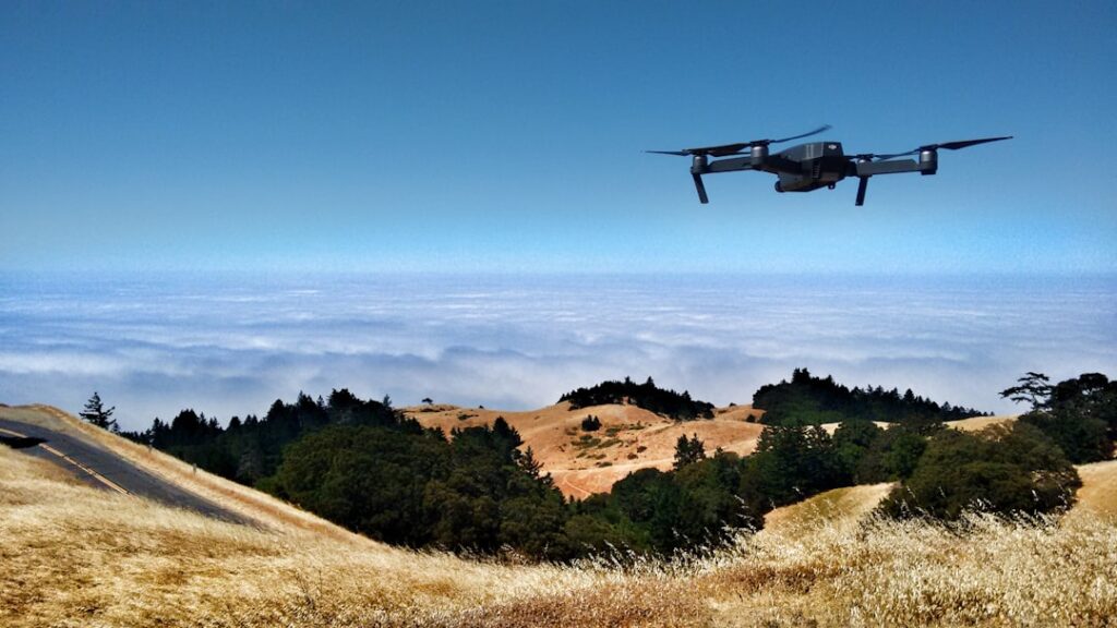
Climbing a steep or storm-damaged roof is one of the riskiest parts of any property inspection, and large commercial roofs and solar arrays can be impractical to walk at all. Drones with thermal imaging let an inspector survey those surfaces from the air, combining a flying platform with an infrared sensor that reveals temperature differences invisible to the eye. Understanding what the thermal payload can resolve, what the flight rules require, and where the technology hits its limits keeps expectations grounded. This guide explains the technology and its inspection uses using trade and regulatory context rather than vendor claims.
What Drones With Thermal Imaging Do
A thermal-imaging drone pairs a small aircraft with an infrared camera that maps surface temperature. Warmer and cooler areas appear as different colors or shades, and on a building those temperature patterns can flag wet insulation, heat loss, or electrical hot spots that a visible-light photo would miss entirely. The drone simply puts that infrared sensor where a person cannot easily or safely go.
The principle is the same as a handheld building thermal camera, explained in our guide to a thermal imaging camera for home inspection; the drone changes the vantage point, not the physics. For roofs, solar farms, and tall facades, the aerial view turns a multi-hour, high-risk survey into a faster, safer flight that can cover ground a person on foot could not.
It is important to frame the drone as a data-gathering platform rather than a magic answer. It collects thermal imagery efficiently from above, but interpreting that imagery still requires the same skills a ground-based thermographer needs, and confirming what an anomaly means still requires follow-up. The aircraft expands reach; it does not replace judgment.
Sensor Resolution and Payload Quality
The single biggest factor in what a thermal drone can see is the resolution of its infrared sensor, and it is far lower than visible cameras.
Thermal resolution versus visible resolution
Consumer thermal sensors often run in modest pixel grids, far below the megapixel counts of ordinary cameras. That means thermal images look coarse, and small features need the drone to fly closer to be resolved. A higher-resolution thermal payload resolves smaller anomalies from farther away, which matters a great deal when surveying a large roof efficiently.
Thermal sensitivity
Beyond pixel count, sensitivity, how small a temperature difference the sensor can distinguish, determines whether subtle wet spots show up at all. Inspection-grade payloads detect finer temperature gradients than entry-level units, which is the difference between catching a developing problem and missing it.
Dual sensors
Many inspection drones carry both a thermal and a visible camera so the operator can correlate a thermal anomaly with what is physically there. Reading the colors correctly takes practice, which our guide to thermal camera color meaning covers in detail.
Flight Rules and Certification Basics
Flying a drone for any inspection work is commercial operation in the eyes of the regulator, and that carries real requirements. In the United States, the Federal Aviation Administration governs drone flight, and commercial operators generally need a Remote Pilot Certificate under the small-drone rule, plus aircraft registration.
Operations must follow airspace restrictions, altitude limits, and visual-line-of-sight rules unless a specific waiver is held. Flying near airports, over people, or in controlled airspace adds further requirements and approvals. For an inspector, this means a thermal drone is not a plug-and-play purchase: it involves certification, registration, and ongoing compliance with the rules.
Building authorities and code bodies such as the International Code Council address building performance, while the flight side sits with aviation regulators, and both matter for legitimate inspection work. Insurance and liability are practical considerations too, since flying an aircraft over a client’s property carries risks a handheld camera does not. Treating the regulatory side as part of the cost of entry keeps an inspection program on solid ground.
Where Thermal Drones Earn Their Keep
The technology shines on large, tall, or hazardous surfaces where ground or ladder access is slow or unsafe.
Roof inspection
On a low-slope commercial roof, trapped moisture under the membrane holds heat differently than dry areas, so a thermal flight can map likely wet insulation across acres far faster than core sampling alone. On residential roofs, the aerial view documents hail and storm damage without a ladder, which is valuable across the hail-prone Front Range.
Solar array inspection
Photovoltaic panels with failed cells or bad connections run hotter, showing up clearly in thermal imagery. Scanning a large array from the air locates underperforming panels quickly, work that would be tedious and time-consuming from the ground.
Large and tall structures
Facades, towers, and bridges that are dangerous or slow to access on foot can be surveyed for heat loss, moisture, and certain defects from a safe standoff distance, reducing both risk and labor.
Energy surveys
Aerial thermal imagery can reveal building-envelope heat loss patterns, complementing the energy-efficiency guidance published by the Department of Energy and helping prioritize where insulation or air sealing would help most.
Real Limits to Understand
A thermal drone is not a magic moisture detector. Thermal imaging shows surface temperature, not moisture directly; it infers wet areas from how they hold and release heat, so findings must be confirmed with a moisture meter or core sample. Coarse sensor resolution limits how small a defect it can catch, and the camera cannot see inside walls or beneath thick insulation.
Conditions matter heavily. Thermal contrast is best when there is a meaningful temperature difference, often early morning or after a sunny day on a roof, so timing the flight is part of the skill rather than a detail. Wind, rain, sun glare, and reflective surfaces all degrade results and can produce misleading patterns.
And no aerial image replaces a hands-on look at accessible problem areas. The drone narrows where to investigate; it does not close the investigation. An inspector who treats a thermal flight as a screening pass, then confirms findings on the ground, gets the value of the tool without overstating what an image alone can prove.
How a Thermal Drone Inspection Actually Runs
A competent thermal-drone inspection is more planned than it looks from the ground. The operator first checks the airspace and weather, confirming the site is clear of restrictions and that conditions allow safe, legal flight. Timing is chosen for thermal contrast, often early morning on a roof, when temperature differences between wet and dry areas are most pronounced and easiest for the sensor to capture.
The flight itself is methodical rather than freeform. The operator flies a consistent pattern at an appropriate altitude and distance so the thermal sensor resolves the features of interest, capturing both thermal and visible imagery for later correlation. Flying too high or too fast leaves anomalies too small to read, so disciplined coverage matters as much as the equipment.
Afterward comes interpretation, which is where the real value lies. The operator reviews the imagery, identifies temperature anomalies, and correlates them with the visible images and with knowledge of how roofs, solar arrays, or facades fail. Genuine findings are then flagged for ground confirmation. A flight that ends with raw images and no interpretation has done only half the job, which is why the skill behind the drone matters more than the drone itself.
What Carries Over From Ground Thermal Imaging
Much of what makes a ground-based thermographer effective carries directly into drone work, which is why the two are best understood together. The physics is identical: in both cases the camera reads surface temperature and infers conditions like trapped moisture or heat loss from the patterns, never measuring moisture directly. An operator who understands that limitation on a handheld camera understands it from the air too.
Interpretation skills transfer as well. Recognizing that a cool patch on a roof might be wet insulation, that a reflective surface can fake a temperature anomaly, and that contrast depends on conditions are lessons learned on the ground that apply unchanged in the air. The drone simply delivers the same kind of image from a new vantage point.
What does not carry over is the flying, the regulatory compliance, and the safety of operating an aircraft, which are genuinely new skills. That split, familiar thermography plus unfamiliar aviation, is exactly why some inspectors pair their own thermal expertise with a certified drone pilot, or hire a service, rather than trying to master both disciplines at once. The thermal knowledge is the half they already have; the flight side is the half that requires new training.
Buying Versus Hiring a Thermal Drone Service
Not every inspector who could use thermal-drone data should own the equipment. The full cost includes the aircraft and payload, the pilot certification, registration, insurance, and the time to develop both flying and thermographic skill. For an inspector who would fly only occasionally, hiring a certified drone-imaging service for the rare large roof or solar job often makes more financial sense than owning, maintaining, and staying current on a drone.
Owning starts to pay off when the volume of suitable work is steady, such as a practice that regularly handles commercial roofs, solar arrays, or large multi-family buildings. At that point the per-job efficiency and the ability to fly on demand justify the investment and the ongoing compliance burden.
For homeowners, ownership is rarely the question; the value is knowing the option exists. A homeowner facing a large or hard-to-access roof can ask whether a drone thermal survey is appropriate, and can judge whether the operator is properly certified and following the rules, which is a reasonable thing to confirm before hiring anyone to fly over the property.
Where It Fits for Front Range Inspections
Colorado’s frequent hailstorms make roof documentation a recurring need across Denver, Douglas, and El Paso counties, and a thermal-and-visible drone speeds storm-damage surveys while keeping inspectors off slick or steep roofs. The region’s growing solar installations are another natural fit, since array faults are tedious to find from the ground. The mountain terrain and large temperature swings also create strong thermal contrast on many days, which can help imaging, though the same weather, gusty winds and rapid changes, can also ground a flight or degrade the results, so local conditions cut both ways.
For most single-family home inspections, a handheld thermal camera and a moisture meter remain the everyday tools, with a drone reserved for large roofs, solar, or genuinely unsafe access. The home inspection tools buyer’s guide places thermal drones in context alongside ground-based thermal imaging and moisture metering, and helps an inspector decide whether the certification and equipment investment matches the work they actually take on.
The honest summary is that a thermal drone is a powerful but specialized addition, not a general-purpose upgrade. It excels precisely where ground methods struggle, on large, tall, or hazardous surfaces, and adds little to a routine inspection of an accessible single-family home. Its value depends on having work that fits its strengths, the certification to fly legally, and the thermographic skill to interpret what it captures. For the right practice and the right buildings, it shortens a risky job into a safe flight; for the wrong ones, it is an expensive tool that mostly stays in its case. Knowing which situation you are in, and whether the work, the certification, and the interpretation skill all line up, is the key decision before investing in or hiring one. When those pieces fit the buildings in front of you, the technology delivers; when they do not, the older ground-based tools remain the smarter choice.
References
- Infrared and Inspection Education — International Association of Certified Home Inspectors (InterNACHI)
- Home Energy Assessments and Thermographic Inspections — U.S. Department of Energy
- Building Performance and Code Resources — International Code Council
Thermal imaging cameras
Infrared cameras reveal hidden moisture, missing insulation, and air leaks. Phone-attachment models are the budget entry point; standalone units have higher resolution.
| Product | Why | Buy |
|---|---|---|
 FLIR ONE Pro (phone) FLIR ONE Pro (phone) | Plugs into iPhone/Android; inspector favorite. | Amazon — $349.00 |
 Topdon TC001 Topdon TC001 | High-res phone module at a low price. | Amazon — $199.99 |
 FLIR C5 Compact FLIR C5 Compact | Standalone pocket camera with Wi-Fi. | Amazon — $449.00 |