Thermal Imaging Drone: A Homeowner Guide
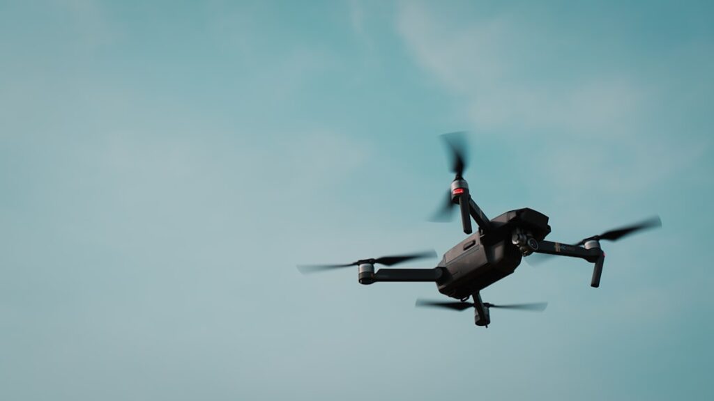
A thermal imaging drone carries an infrared camera into places a ladder cannot safely reach, most commonly a roof. Flying a heat-sensing camera over a steep or fragile surface lets an inspector spot trapped moisture, missing insulation, and damaged areas without setting foot on the shingles. The drone does not see through the roof, though; it reads surface temperature, and weather and skill heavily shape the result. This guide explains how aerial thermal inspection works in plain language, drawing on energy and inspection-industry references rather than any single drone or camera maker.
Part of our Thermal Imaging for Homes guide — start there for the full picture →
What is a thermal imaging drone?
A thermal imaging drone is an unmanned aircraft fitted with an infrared camera, usually alongside a standard visible camera. The infrared sensor reads long-wave heat radiation from surfaces below and turns temperature differences into a color image streamed to the operator’s controller.
The aircraft supplies access and a stable platform; the thermal camera supplies the diagnostic data. Most inspection drones blend the thermal and visible feeds so the operator can tell exactly where a heat anomaly sits on the structure.
What a thermal drone reveals on a roof
The Department of Energy recognizes infrared scanning as a way to find building heat loss, and a roof is one of the hardest places to scan from the ground.
Trapped moisture under the membrane
On flat or low-slope roofs, water that seeps below the membrane holds heat differently than the dry roof around it. After sunset, wet areas often release stored heat more slowly and appear warmer, revealing the wet zones. This is the classic aerial roof-moisture survey.
Missing insulation and heat loss
Gaps in roof or attic insulation show as warm patches in winter, where indoor heat escapes more freely.
Damaged or displaced material
The visible camera alongside the thermal sensor documents cracked tiles, lifted shingles, and flashing problems that warrant a closer look.
Why a drone for roofs?
The strongest argument for a drone is safety. Walking a steep, wet, or fragile roof is one of the more dangerous tasks in home inspection, and falls are a serious risk. A drone keeps the operator on the ground while still capturing close, detailed imagery of the roof surface.
Access is the second argument. Very tall, large, or complex roofs are slow and risky to inspect on foot, and some cannot be walked at all without damaging the covering. A drone surveys the whole surface quickly, and the aerial view often reveals patterns, like a moisture plume spreading from a single failure point, that are hard to see standing on the roof itself.
The specs that drive results
Two camera numbers matter most. Sensor resolution, in pixels, sets the detail; higher resolution lets the drone fly higher and still resolve a small anomaly. Thermal sensitivity, given as NETD in millikelvin, sets how subtle a temperature difference the camera can show, which is decisive for faint moisture patterns.
Flight factors matter too. Stable hover, wind tolerance, and battery endurance determine how much roof you can survey per flight. A radiometric thermal camera, which records a temperature value for every pixel, lets the operator analyze readings afterward rather than just viewing a live color image.
Radiometric versus non-radiometric
The distinction is worth understanding before buying or hiring. A non-radiometric drone camera shows a live thermal image but stores only the colors, not the underlying temperatures, so analysis after the flight is limited to what the eye saw. A radiometric camera records a measurable temperature for every pixel, so an operator can examine specific points, adjust the analysis, and document exact differences after landing. For serious roof-moisture work, radiometric capability turns a flight into evidence rather than a slideshow, which is why it commands a higher price.
Timing and weather are everything
Aerial thermal roof surveys depend on conditions more than almost any other inspection method. The best window is usually after sunset on a dry day, once the roof has absorbed solar heat and begins releasing it; wet areas then stand out by cooling or warming at a different rate.
Wind, recent rain, cloud cover, and standing water all degrade or invalidate a survey. A roof scanned in the wrong conditions produces images that look meaningful but mean nothing. Treat every anomaly as a lead to verify, the same way you would with a handheld scan, and confirm suspected moisture with a moisture meter and an understanding of the physics.
The thermal lag effect
The reason timing matters comes down to how materials hold heat. Wet insulation and trapped moisture have more thermal mass than the dry roof, so they heat and cool more slowly. During the day, the sun loads heat into the whole roof and the difference is masked. As the roof cools after sunset, the wet areas lag behind, holding their warmth longer and standing out against the cooling dry surface. Fly too early and the contrast has not developed; fly the wrong night after rain and the whole roof reads uniformly wet. Reading this lag correctly is much of the skill in aerial roof thermography.
Beyond roofs: other inspection uses
While roofs are the headline application, a thermal drone has other inspection roles. On large exterior walls and multi-story facades, it can scan for insulation gaps and air leaks that would be slow to reach from the ground. On solar installations, it can spot underperforming panels that run hotter than their neighbors. For acreage common on the rural Front Range, it can survey outbuildings and barn roofs that are awkward to access on foot.
In each case the same physics and the same limits apply. The drone reads surface temperature, so it flags anomalies rather than diagnosing them, and the findings still need ground-level confirmation. The aerial vantage simply makes large or tall surfaces practical to scan, capturing in one flight what would take hours of ladder work and carry real fall risk.
Drone versus handheld thermal camera
The choice between a drone and a handheld camera comes down to access. A handheld camera is cheaper, simpler, and needs no pilot certificate, and it works well for interior scans and any surface you can safely reach. A drone’s advantage is purely about getting the camera to places a person cannot safely go, chiefly steep, tall, or fragile roofs.
For most homeowners, a handheld camera covers the interior energy-audit and moisture-screening needs at a fraction of the cost and complexity. A drone makes sense for professionals who regularly inspect roofs and have the licensing and training to fly legally. Thinking of the drone as a specialized access tool, rather than a general upgrade over a handheld, keeps the decision grounded in what each one is actually for.
Rules and licensing
Flying a drone for inspection work, even occasionally, falls under aviation regulations. Commercial drone operation in the United States generally requires a remote pilot certificate, and operators must follow airspace rules, altitude limits, and line-of-sight requirements. Privacy considerations apply when flying over neighboring property.
A homeowner cannot simply buy a drone and offer roof surveys to others without meeting these requirements. Many home inspectors who offer aerial scans either hold the certificate or subcontract a licensed pilot.
Interpreting the aerial images
Reading an aerial thermal image takes care, because not every temperature difference signals a problem. A warm area might be trapped moisture, but it could also be a sunlit slope that has not yet cooled, a rooftop unit shedding heat, or a section shaded differently from the rest. The operator must account for the building’s layout, the time since sunset, and the position of equipment before calling an anomaly a defect.
The strongest evidence comes from patterns that make physical sense. Moisture under a membrane often spreads outward from a failure point like a seam or a drain, producing a connected, irregular shape rather than a sharp-edged rectangle. Comparing the thermal image against the matching visible photo helps separate real wet zones from surface features. Even then, the aerial finding is a lead, and ground-level confirmation with a moisture probe is what turns a suggestive image into a documented conclusion.
Limits to keep in mind
A thermal drone reads surface temperature, so it does not see through the roof deck or into the structure. It does not detect mold; it can only flag the moisture that mold needs. It cannot measure moisture content, which is why ground-level confirmation still matters.
Resolution on consumer drone cameras is often lower than on a dedicated handheld unit, and reflective surfaces such as metal roofing can mislead if emissivity is not handled. InterNACHI guidance stresses interpreting thermal patterns rather than trusting raw numbers on shiny materials.
Planning a survey flight
A productive flight takes planning, not just a charged battery. The operator checks the weather window first, aiming for a dry evening after the roof has warmed in the sun and begun cooling, so trapped moisture stands out. Wind speed, cloud cover, and recent rain are all checked, since any of them can invalidate the survey.
Airspace comes next. The operator confirms the location is not in restricted or controlled airspace without authorization, and notes any obstacles like power lines, trees, and nearby structures. Battery planning matters because a large roof may need several flights, and a radiometric camera’s data files take time to capture properly. A methodical grid pattern, holding a consistent height and overlap, produces coverage that can be analyzed afterward, rather than a scattered set of images that miss spots. This preparation is much of what separates a useful aerial survey from a few pretty pictures.
Where a drone fits in an inspection
A thermal drone shines for steep, fragile, large, or otherwise inaccessible roofs, and for documenting roof condition safely. It complements rather than replaces ground-based tools. An inspector typically uses the drone to find suspect areas, then confirms with closer inspection where access allows.
The home inspection tools hub places aerial thermal imaging alongside handheld cameras and moisture meters, and our overview of digital infrared camera categories explains how the airborne sensor compares with the handheld classes.
When to call a professional
Aerial roof thermography rewards experience. A trained, licensed operator knows the right weather window, the airspace rules, and how to separate real moisture from sun and wind artifacts. For a roof condition question on a home purchase, a professional aerial survey backed by ground confirmation is far more reliable than a hobby flight, and it keeps the operator off a dangerous surface.
The skill gap is real. An untrained flier may capture striking images that mean little, missing the right timing or reading sun-heating as moisture. A professional combines the flight, the weather judgment, and the ground confirmation into a single defensible conclusion, which is what a buyer or insurer actually needs.
There is also the matter of liability and legality. A commercial roof survey carried out without the required pilot certification, or flown carelessly near people or property, exposes the operator to real consequences. A licensed professional carries the credentials and usually the insurance to do the work properly, which protects everyone involved. For a roof question that bears on a purchase or a claim, hiring that professional is not only more accurate but also the responsible way to get an aerial survey done, rather than improvising with a consumer drone and hoping the images hold up. The drone is a remarkable access tool in the right hands, and the right hands are what make its findings dependable. For a homeowner, the practical takeaway is to value the technology for what it does best, reaching dangerous or inaccessible roofs safely, while recognizing that the weather judgment, the flying skill, and the ground confirmation behind a trustworthy survey are exactly what a qualified professional brings to the job.
References
- ENERGY STAR: Seal and Insulate — U.S. Environmental Protection Agency (ENERGY STAR)
- Infrared Thermal Imaging Inspection — InterNACHI
- A Brief Guide to Mold, Moisture and Your Home — U.S. Environmental Protection Agency
Frequently asked questions
What does a thermal imaging drone detect on a roof?
It detects surface temperature differences that reveal trapped moisture under the membrane, missing insulation, and heat loss. Paired with a visible camera, it also documents cracked tiles, lifted shingles, and flashing problems from a safe distance.
When is the best time to fly a thermal roof survey?
Usually after sunset on a dry day, once the roof has absorbed solar heat and begins releasing it. Wind, recent rain, and standing water degrade the survey, so conditions matter as much as the equipment.
Do I need a license to fly a thermal inspection drone?
Commercial drone operation in the United States generally requires a remote pilot certificate, plus compliance with airspace, altitude, and line-of-sight rules. A homeowner cannot legally offer roof surveys to others without meeting those requirements.
Can a thermal drone see through a roof?
No. It reads surface temperature only. It reveals trapped moisture and insulation gaps indirectly through their effect on the surface, but it never images the structure beneath the roof deck.
Thermal imaging cameras
Infrared cameras reveal hidden moisture, missing insulation, and air leaks. Phone-attachment models are the budget entry point; standalone units have higher resolution.
| Product | Why | Buy |
|---|---|---|
 FLIR ONE Pro (phone) FLIR ONE Pro (phone) | Plugs into iPhone/Android; inspector favorite. | Amazon — $349.00 |
 Topdon TC001 Topdon TC001 | High-res phone module at a low price. | Amazon — $199.99 |
 FLIR C5 Compact FLIR C5 Compact | Standalone pocket camera with Wi-Fi. | Amazon — $611.50 |