Drones With Thermal Camera: What Homeowners Need to Know
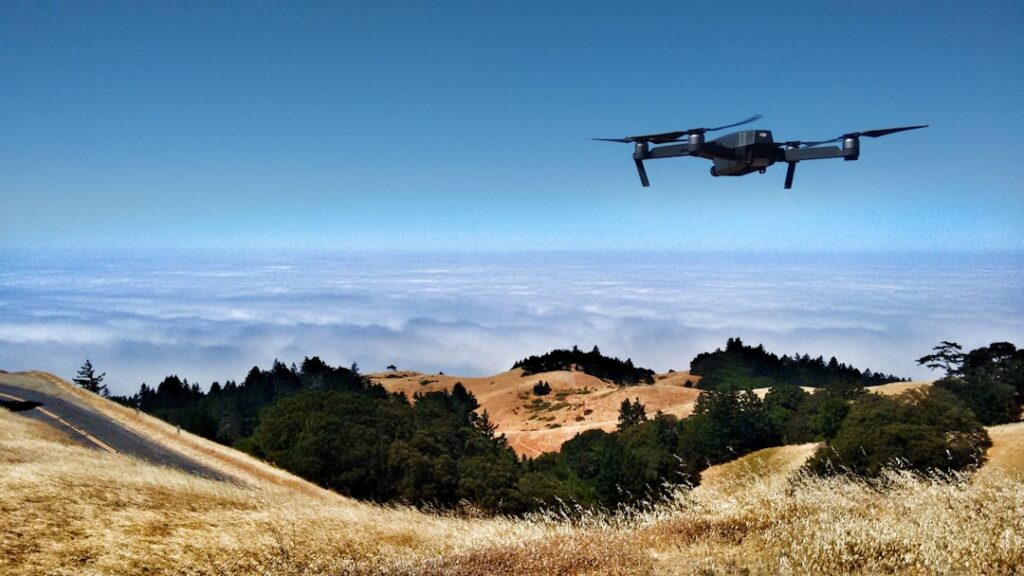
Thermal-equipped drones have moved from specialty aerospace and industrial markets into the working home inspector’s kit over the past several years. The combination of an aerial platform with a calibrated thermal sensor allows inspectors to scan roof surfaces, building envelopes, and large properties from positions a ladder cannot reach. This guide covers the platforms available in 2026, the price tiers homeowners and working inspectors are evaluating, the applications that justify the investment, and the FAA Part 107 commercial-use rules that govern paid thermal drone work.
Part of our Thermal Imaging for Homes guide — start there for the full picture →
Why thermal on a drone matters for home inspection
Ground-level thermal imaging shows a lot — wet drywall, missing insulation, electrical hot spots, plumbing leaks behind walls. But several inspection categories live above ground level or require viewing surfaces at angles ladder-mounted users cannot achieve safely.
Roof surface assessment
Thermal cameras flown above a roof show heat patterns indicating where insulation is missing or compressed, where wet roofing membrane has absorbed moisture and retained heat, where flashing is failing, and where rooftop equipment is creating thermal anomalies. Walking a roof is dangerous and limited; flying a roof captures the entire surface in minutes.
Building envelope
From an aerial perspective, the building exterior shows heat-loss patterns across the entire wall surface continuously, not in the segments visible from ground-level positions. Air leakage, missing insulation, thermal bridging, and moisture in walls all show in thermal imagery from the air.
Large properties
For properties with substantial acreage — large estates, ranch properties, commercial buildings, multi-building campuses — aerial thermography covers ground in a fraction of the time required for ground-based imaging.
Hard-to-reach areas
Steep roofs, multi-story buildings, areas with limited ground access, and inspections that would otherwise require lift equipment or extensive ladder work are all accessible by drone.
Platforms used by working inspectors in 2026
Several drone platforms with integrated thermal sensors are common in the inspection market. Pricing varies widely by tier; the categories below describe capability tiers without endorsing specific manufacturers.
Compact integrated dual-camera platforms
Smaller drones with a fixed dual-camera gimbal — a visible-spectrum camera plus a thermal sensor — designed for portability and ease of operation. Typical thermal resolution at this tier ranges from 320×240 to 640×512 pixels. Pricing is in the range of $3,000-7,000 for the platform plus thermal package. Battery life typically 30-45 minutes per flight. Suitable for residential and small-commercial inspection work.
Mid-tier inspection platforms
Larger drones with interchangeable payload bays or fixed higher-resolution thermal packages. Thermal resolution 640×512 standard, with some platforms offering higher. Visible-spectrum camera with higher resolution and zoom. Pricing $7,000-15,000+ for platform plus thermal payload. Battery life typically 35-55 minutes. Used for larger commercial and industrial inspection along with residential.
Heavy-lift modular platforms
Multi-payload drones capable of carrying higher-end thermal sensors, lidar, and other instruments simultaneously. Pricing in the range of $15,000-50,000+ for fully configured systems. Used for industrial inspection, infrastructure work, and specialized applications. Beyond typical residential inspection use.
What thermal resolution actually does for inspection imagery
Thermal sensor resolution determines how much spatial detail the thermal image captures. The distinction matters because thermal anomalies smaller than several pixels are difficult to identify reliably.
Lower-resolution sensors (160×120 to 320×240)
Useful for identifying large thermal patterns — overall building heat loss, large insulation gaps, major wet areas. Fine detail at distance is limited. Suitable for general energy-audit context or as a screening tool that informs follow-up ground inspection.
Mid-resolution (640×512)
The current standard for most inspection-grade aerial thermal sensors. Captures meaningful detail of building envelope patterns, roof anomalies, and equipment hot spots at typical inspection-flight altitudes. Adequate for documentation suitable for client reports.
Higher-resolution (1280×1024 and above)
Specialty tier. Used for industrial inspection where small thermal anomalies must be detected at altitude. Less common in residential inspection due to cost.
FAA Part 107 and commercial-use requirements
Any commercial use of a drone in the United States — including paid home inspection services using a thermal drone — requires the operator to hold an FAA Part 107 Remote Pilot Certificate. This is non-negotiable for working inspectors. The certificate requires passing an aeronautical knowledge test, registering with the FAA, and following Part 107 operational rules. Recurrent training requirements apply.
Beyond Part 107, several operational rules constrain commercial drone use. Drones must remain within visual line of sight of the operator (unless a specific waiver applies). Maximum altitude is 400 feet above ground level. Operation over moving vehicles or non-participants is restricted. Operation at night and beyond visual line of sight require specific waivers. Operation in controlled airspace (near airports, in restricted zones, in temporary flight restrictions) requires authorization, typically through the LAANC system.
Homeowners flying a thermal drone for personal use of their own property do not need Part 107 certification, but recreational rules still apply, including the requirement to take the TRUST recreational pilot test and to follow community-based organization safety guidelines.
Practical applications for residential inspection
The thermal-drone applications that justify the investment for working inspectors and serious homeowners cluster in several categories.
Roof leak source identification
Ceiling stains inside a home indicate a roof leak somewhere upstream. The actual leak point on the roof may be several feet from the ceiling stain due to water tracking along framing. Thermal imaging of the wet roof during or after a rain event shows the actual saturation pattern, locating the leak point for repair.
Wet roofing membrane survey
Flat or low-slope commercial and residential roofs sometimes have wet insulation beneath the membrane that is not visible from the surface. Thermal scanning at the appropriate time of day (typically several hours after sunset when retained heat in wet areas differentiates from dry areas) maps the wet areas without invasive testing.
Building envelope energy assessment
Aerial thermography during winter (or under significant indoor-outdoor temperature differential) shows where heat is escaping the envelope. Useful for energy-audit work and for documenting before-and-after improvements. The home inspection tools buyer guide covers thermal imaging more broadly.
Large-property anomaly screening
For ranch properties, commercial campuses, and large estates, aerial thermal screening identifies areas warranting closer ground-based inspection without requiring complete ground coverage. A 100-acre property might be screened in a few flight hours.
HVAC and equipment thermal inspection
Rooftop HVAC equipment, condensing units, and other rooftop installations show thermal patterns indicating performance, blockages, and component failures. Drone-based inspection of large rooftop installations is faster and safer than walking the roof.
Pricing context for inspection-business decisions
The decision to invest in a thermal drone is significant for a working inspector. Several context points:
Equipment cost
Entry-level inspection-grade thermal drone platforms run approximately $3,000-7,000 for the platform plus thermal package. Mid-tier platforms run $7,000-15,000+. Add controller, batteries (multiple needed for full-day work), case, training, insurance, and the all-in initial investment commonly exceeds $5,000 even at the entry tier.
Training and certification
FAA Part 107 certification involves study time, test fee, and renewal cycle. Practical operation training for thermal interpretation adds value but is rarely formally required. Insurance for commercial drone operation is a separate consideration.
Revenue context
Thermal drone service typically commands premium pricing in inspection markets — additional fees ranging from $150-500+ per inspection depending on scope and region. The investment payback depends on volume; high-volume inspectors recoup costs faster than occasional users. Some inspectors offer drone thermography as a specialty add-on rather than including it in standard scope.
Alternatives
For inspectors not ready to invest, sub-contracted drone services from local drone operators are available in most markets. The inspector identifies the use case, the drone operator handles the flight and provides imagery for inclusion in the inspection report. Our guide on thermal imaging camera drones covers the platform and payload integration in more detail.
Limitations worth understanding
Thermal drones are not magic. Several constraints affect what they can detect.
Weather and environmental conditions
Wind, rain, snow, and fog all limit drone operation. Most platforms have published wind-tolerance specs (typically 10-15 meters per second maximum). Thermal contrast often requires specific environmental conditions — temperature differential, recent precipitation, time of day — to produce meaningful imagery. Scheduling thermal flights for optimal conditions is part of the workflow.
Surface conditions
Wet roofs after rain show wet areas. Dry roofs do not. Solar heating during the day overwhelms many thermal patterns that are visible at night. Surface reflectivity (emissivity) affects thermal readings — shiny metal surfaces are notoriously difficult to image accurately.
Interpretation requires expertise
Thermal imagery shows temperature patterns, not problems directly. A trained operator distinguishes meaningful anomalies from artifacts like solar reflection, shadow patterns, and equipment exhaust. Untrained interpretation produces false positives and missed real problems.
Privacy and operational concerns
Drone operation over neighbor properties, near schools and public events, and in dense urban environments raises privacy and operational concerns that good operators address proactively. Notification of property owners, flight planning to minimize over-flight of non-client properties, and adherence to local rules are standard professional practice.
Battery, flight time, and operational planning
Inspection-grade drones consume batteries quickly. Realistic flight time per battery in 2026 inspection platforms ranges from 30-55 minutes, with effective hover and survey time shorter than the advertised maximum due to safe-landing reserve requirements. Larger inspection jobs require multiple batteries, charging logistics, and time management.
A typical residential roof and envelope scan takes 15-30 minutes of effective flight time, easily within a single battery. Large-property scans (multi-acre estates, large commercial sites) require multiple battery swaps and an operator workflow that integrates charging time. Cold weather reduces battery performance — Front Range winter conditions sometimes reduce flight time by 20-30 percent compared to mild-weather operation.
Insurance and operational coverage
Commercial drone operation typically requires aviation liability insurance separate from general business liability. Coverage limits, hull coverage (insurance on the drone itself), and special endorsements for thermal payload value vary by carrier. Annual premiums for commercial drone operations commonly run several hundred to over a thousand dollars depending on coverage limits and operational profile.
For inspectors integrating thermal drone services, the insurance review typically extends to general liability (extending to drone operations), errors-and-omissions on the inspection report deliverable, and aviation-specific coverage. Discussing with an aviation-specialty insurance broker before commercial operations begin is the standard professional approach.
References
- ENERGY STAR: Seal and Insulate — U.S. Environmental Protection Agency (ENERGY STAR)
- Aerial inspection and tool use for residential work — International Association of Certified Home Inspectors
- Standards of practice for home inspection — American Society of Home Inspectors
Frequently asked questions
Do I need a license to fly a thermal drone for home inspection?
For any commercial use including paid home inspection services, FAA Part 107 Remote Pilot Certificate is required in the United States. Personal use of a drone on your own property does not require Part 107, but recreational rules including the TRUST test apply.
How much does an inspection-grade thermal drone cost?
Entry-level inspection platforms with thermal payload run $3,000-7,000. Mid-tier platforms run $7,000-15,000+. Specialized heavy-lift platforms run $15,000-50,000+. Add controller, batteries, training, and insurance to the platform cost.
What can a thermal drone find that ground thermal cannot?
Roof surface anomalies, wet roofing membrane patterns, building envelope heat-loss patterns across the entire exterior, and large-property screening — all from positions that ground-based imaging cannot access safely or efficiently.
Thermal imaging cameras
Infrared cameras reveal hidden moisture, missing insulation, and air leaks. Phone-attachment models are the budget entry point; standalone units have higher resolution.
| Product | Why | Buy |
|---|---|---|
 FLIR ONE Pro (phone) FLIR ONE Pro (phone) | Plugs into iPhone/Android; inspector favorite. | Amazon — $349.00 |
 Topdon TC001 Topdon TC001 | High-res phone module at a low price. | Amazon — $199.99 |
 FLIR C5 Compact FLIR C5 Compact | Standalone pocket camera with Wi-Fi. | Amazon — $611.50 |