Drone With Thermal Camera for Deer Recovery: Editorial Note
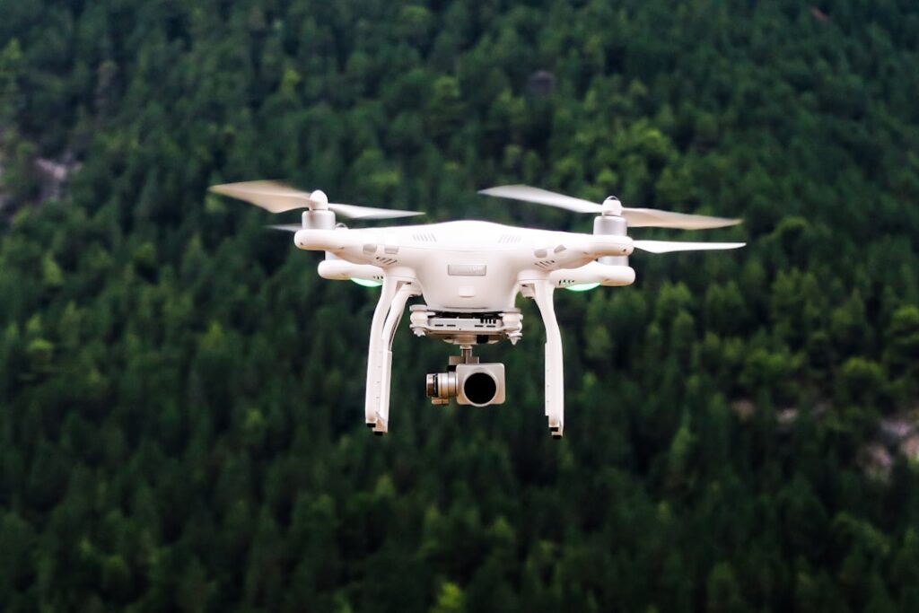
The search “drone with thermal camera for deer recovery” reaches a hunting and wildlife recovery question, not a residential inspection question. Hunters use thermal drones to locate wounded game after low-visibility shots, and the technology, regulations, and operator skills involved sit outside InspectandTest’s editorial scope. We cover residential home inspection: roof and envelope diagnostics, water damage detection, electrical and HVAC inspection, and the tools licensed inspectors use in that work. This article notes that scope mismatch up front and then pivots to the residential and structural applications of thermal-equipped drones that share the underlying technology but serve completely different work.
Part of our Thermal Imaging for Homes guide — start there for the full picture →
Why this is off-pillar for InspectandTest
Hunting and game-recovery operations occur on private and public hunting lands, follow state wildlife regulations administered by departments of natural resources, and involve operator skills, ethics, and equipment choices specific to wildlife work. Pointing a residential-inspection audience at hunting guidance risks giving readers information that does not match their actual situation, and pointing hunters at residential-inspection guidance does the same. Readers researching deer recovery should consult their state’s wildlife management agency, hunter-education resources, and operator communities that specialize in tracking and recovery practice.
The remainder of this article covers what thermal drones do in residential and commercial structural inspection, which shares the underlying hardware category but applies it to entirely different work.
Thermal-equipped drones in residential inspection
A drone-mounted thermal camera captures roof surfaces, exterior envelopes, and elevated structural elements without a ladder. The drone hovers at controlled altitudes, the gimbaled thermal payload stabilizes the camera, and the operator records radiometric video or stills that show surface temperature patterns across large areas in minutes. For roof inspection specifically, the thermal drone has changed the workflow on three categories of problem.
Wet roof insulation
Flat and low-slope roofs accumulate moisture under the membrane when seams fail or flashings leak. The wet insulation holds solar-heat energy and releases it slowly after sunset, while dry insulation cools quickly. A thermal scan in the hour after sunset shows wet zones as warmer bright patches against the cooler dry roof. This is the standard methodology for commercial flat-roof moisture surveys and works on residential flat additions, garage roofs, and modern low-slope assemblies. ASHRAE technical literature on building diagnostics covers the underlying physics and timing of this scan method.
Missing or compressed insulation
Steep-slope roofs over conditioned attics show different surface temperatures based on insulation continuity below the deck. Gaps in batts, compressed insulation around recessed lights, and chimney chase voids photograph as warmer or cooler patches depending on indoor-outdoor temperature differential. Inspectors use this information to direct attic-side investigation of insulation defects.
Active water intrusion
An active leak from a roof penetration shows as a cooler plume during evaporative cooling or a warmer plume during winter when conditioned indoor air escapes through the wet path. Thermal drones identify the surface termination of leak paths, after which traditional ladder-based investigation confirms cause.
Commercial Part 107 framework
Civilian operators using thermal drones for commercial inspection work in the United States operate under FAA Part 107 small UAS rules. The certification requires passing a knowledge exam, registering aircraft above 0.55 lb, observing operating limits including visual line-of-sight requirements and altitude caps, and complying with airspace restrictions. Commercial residential roof inspection is squarely Part 107 work. Operators flying for property inspection insurance claims, restoration contractor estimating, or pre-purchase home inspection should hold current Part 107 certification.
Our pillar overview on home inspection tools for 2026 covers drone-based thermal inspection alongside handheld thermography and other inspection tools.
Drone thermal payload specifications
Residential inspection drones with thermal payloads typically carry 320 by 240 to 640 by 512 thermal sensors. The lower end suffices for general roof scanning at typical altitudes of 50 to 100 feet; the upper end produces sharp detail useful for forensic-level documentation in insurance claim work.
Thermal sensitivity (NETD). Drone thermal payloads typically run 40 to 60 mK NETD, comparable to mid-tier handhelds. Sensitivity at the drone tier matters for capturing subtle envelope detail, particularly in shoulder-season scans with moderate delta-T conditions.
Radiometric capability. Radiometric thermal video records absolute temperature data per pixel rather than just visual color mapping. Inspectors processing roof scans in post-production analysis software need radiometric output to apply emissivity corrections, isolate temperature ranges, and generate quantitative reports.
Gimbal stabilization. Three-axis stabilized gimbals isolate the thermal sensor from drone vibration and wind buffeting, producing usable imagery at the longer dwell times thermal sensors require compared with visible-light cameras.
Wildlife in residential structures
One residential application of thermal drone work that overlaps loosely with wildlife topics involves detecting wildlife intrusion in attics, soffits, and exterior wall cavities. Raccoons, squirrels, bats, and birds register as heat signatures on thermal imagery taken from the exterior at appropriate angles. This is a niche application within home inspection used by pest control operators and inspectors investigating reported attic noise or smell. The drone approach works for inaccessible roofs and dormers where ground-level handheld thermal cameras cannot see the relevant elevated surfaces.
For this work, the methodology, regulatory framework, and operator skills are identical to standard roof-inspection thermography. The drone is doing residential-inspection work that happens to detect biological heat sources rather than building heat sources.
What thermal drones do not do well in residential inspection
Several misconceptions surface in homeowner questions about thermal drone capabilities.
They do not see through roofing. The thermal camera reads the outer roof surface temperature. Subsurface conditions appear only when those conditions cause surface temperature contrast. A dry roof over a leaking valley shows nothing thermal until the leak migrates to a surface-affecting moisture path.
They do not measure absolute moisture content. Thermal scans flag temperature anomalies that correlate with moisture; they do not measure moisture content directly. Pin moisture meters and pinless capacitance meters verify and quantify after the thermal scan identifies the location.
They do not work in all weather. Wet exterior surfaces from recent rain or dew confound thermal imagery for hours after the precipitation ends. Direct solar loading on shingles saturates the image until shadows or post-sunset cooling reveal the underlying patterns. High wind makes drone flight unsafe or unproductive regardless of payload.
Hardware tiers in commercial drone thermal
Commercial drone thermal payloads come from a small set of established manufacturers in the $4,000 to $12,000 hardware tier for the inspection-specific configurations operators actually buy. Lower-cost consumer drones with bolt-on or integrated thermal cameras serve hobbyist and entry-tier inspection work but rarely produce the radiometric output and image quality professional reports need. Roof inspection contractors typically lease or own a Part 107-capable platform with a dedicated thermal payload and a separate visible-light camera for cross-reference.
For the price ranges and detailed comparison of drone-thermal configurations in residential and commercial use, see the existing best drones with thermal camera commercial buyer guide.
When the homeowner should hire versus DIY
A homeowner curious about roof condition can fly a sub-250-gram recreational drone with a basic visible-light camera under recreational rules and get useful visual roof imagery. Adding thermal imaging crosses into commercial-payload pricing and Part 107 territory that rarely makes sense for a one-time homeowner application. Hiring a Part 107 operator with a thermal payload for a residential roof scan runs $300 to $700 in most markets and delivers usable inspection-grade output without the operator training the homeowner would otherwise need to acquire.
Worker safety on roof access
OSHA-regulated worker access to roofs above six feet requires fall protection compliance for any worker traversing the surface. Drone thermal scanning eliminates the worker-on-roof exposure for the scanning step, which is a meaningful safety benefit on steep-slope and storm-damaged roofs. Inspectors and contractors who fly drone scans before any climbing decision reduce fall-injury exposure across the workflow.
When residential thermal drone work actually fits
Three residential scenarios justify the thermal-drone investment over alternative tools.
Steep-slope roofs
Tile, slate, and steep-pitch composition roofs present fall hazards that justify drone scanning over ladder access. The drone images the same surface details a roof-walking inspector would observe but without the climbing exposure. Insurance and lender documentation often accepts drone-captured imagery as equivalent to walk-on inspection when the operator is Part 107 certified and the imagery includes the relevant detail.
Flat and low-slope roofs
Commercial-style flat roofs on residential additions, garages, and modern low-slope homes benefit from thermal scanning that identifies wet insulation below the membrane. The scan timing matters: post-sunset within the first hour after sundown produces the clearest contrast between wet and dry zones because the wet insulation releases stored solar heat slowly while dry zones cool rapidly.
Storm-damaged roofs
Hail-damaged and wind-damaged roofs may be unsafe to walk on regardless of slope. The thermal drone documents condition without crew exposure and supports insurance claim documentation in the period between storm event and roof replacement.
Pre-flight planning for residential thermal scans
A productive residential thermal scan involves planning steps that the operator completes before flight.
Weather window. Recent precipitation, wet surfaces from dew, and direct solar loading all degrade thermal image quality. The optimal window is twelve to twenty-four hours after the last significant precipitation, with the scan timed for thirty to ninety minutes after sunset to capture the strongest thermal contrast on the roof surface.
Indoor conditioning. The home’s HVAC should be operating at normal occupied setpoints. Scans of vacant homes with HVAC off produce minimal envelope contrast and few useful findings.
Airspace verification. Even rural residential locations may sit within controlled airspace boundaries. Pre-flight airspace check through the appropriate FAA-approved tools confirms the flight is authorized before the operator arrives at the property.
Site walkthrough. Identify tree obstructions, overhead utility lines, and adjacent structures that affect flight path. Brief the homeowner on flight duration and expected workflow.
Reading the resulting imagery
Thermal drone imagery from a residential roof scan typically captures the entire roof surface in a series of overlapping images that the operator stitches into a composite map. Common findings include cooler zones around chimney chases (often indicating missing insulation), warmer stripes along ridge vents (indicating heat plume from conditioned space), and localized patches that may reflect moisture intrusion or missing insulation.
Pattern interpretation requires training and experience. Newer operators benefit from working alongside a certified thermographer during initial flights to develop pattern recognition. Misreading benign patterns as findings or missing actual problems both occur with high frequency in operators without formal thermography training.
The Front Range context
Colorado Front Range climate produces useful thermal scan conditions roughly three quarters of the year. Winter scans benefit from large indoor-outdoor temperature differentials that produce strong envelope contrast. Summer scans work for HVAC and electrical diagnostics but provide weaker envelope information. Spring and fall produce variable conditions; the operator may need to schedule around weather windows more carefully than during stable winter or summer.
Hail season from May through August affects scheduling on residential drone work. Operators planning thermal scans on potentially hail-damaged roofs typically schedule shortly after weather events while the damage is fresh, supporting insurance claim documentation.
References
- Fall Protection Standards for Roof Work — OSHA
- Infrared Inspection Certification and Standards — InterNACHI
- Building Envelope Thermal Diagnostics — ASHRAE
- ENERGY STAR: Seal and Insulate — U.S. Environmental Protection Agency (ENERGY STAR)
Thermal imaging cameras
Infrared cameras reveal hidden moisture, missing insulation, and air leaks. Phone-attachment models are the budget entry point; standalone units have higher resolution.
| Product | Why | Buy |
|---|---|---|
 FLIR ONE Pro (phone) FLIR ONE Pro (phone) | Plugs into iPhone/Android; inspector favorite. | Amazon — $349.00 |
 Topdon TC001 Topdon TC001 | High-res phone module at a low price. | Amazon — $199.99 |
 FLIR C5 Compact FLIR C5 Compact | Standalone pocket camera with Wi-Fi. | Amazon — $611.50 |