Color Infrared Camera: What Homeowners Need to Know
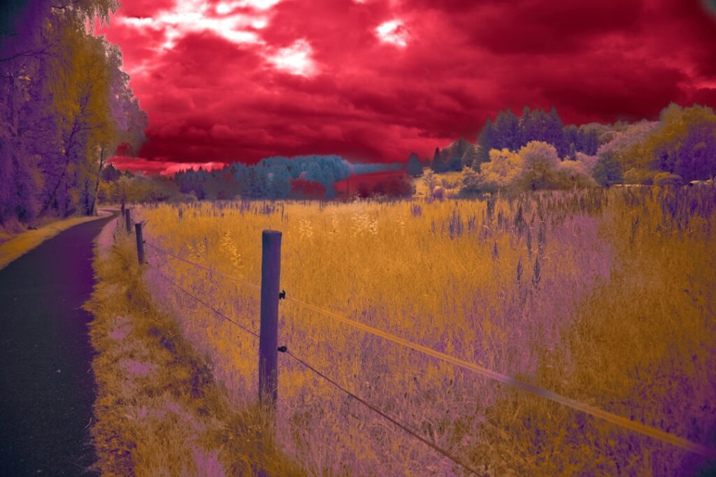
A color infrared camera is sometimes mistaken for a thermal camera because both produce false-color images and both involve “infrared” in their names. The technologies are entirely different. Color infrared (sometimes called CIR or false-color IR) maps near-infrared, red, and green visible light into RGB display channels to reveal patterns invisible to ordinary photography. It does not measure temperature. It is the technology behind aerial vegetation surveys, art-pigment analysis, and forensic document imaging. For home inspection moisture and energy work, the relevant tool is a long-wave thermal camera, not a color infrared camera. This guide explains what color infrared actually does, where it overlaps and diverges from thermal imaging, and when each tool is the right choice.
What color infrared imaging actually is
Color infrared photography captures three bands of light: near-infrared (NIR, roughly 0.7 to 1.0 micrometers), red visible (around 0.65 micrometers), and green visible (around 0.55 micrometers). These three bands are mapped to the three RGB channels of a display: NIR goes to the red channel, red visible goes to the green channel, and green visible goes to the blue channel. The resulting image looks alien — healthy vegetation appears bright red because chlorophyll reflects near-infrared strongly, water appears black, and built structures appear in muted blue-gray tones. The mapping is a deliberate convention that emerged from aerial film photography in the mid-twentieth century and continues in modern digital false-color imaging.
How color infrared differs from thermal imaging
Color infrared is a reflectance-based technology. It captures reflected sunlight or active illumination in three spectral bands and renders the bands as false-color images. The data values describe what wavelengths a surface reflects. Thermal imaging (LWIR, 8 to 14 micrometers) is an emission-based technology. It measures the long-wave radiation that surfaces emit at typical building temperatures. The data values describe surface temperature. The two technologies look superficially similar (both produce false-color images) but answer different questions: color IR asks “what does this surface reflect?”, thermal asks “how hot is this surface?”. Confusing the two leads to buying the wrong tool for a given inspection task.
Primary use cases for color infrared
Three industries use color infrared heavily. Agricultural vegetation monitoring uses NIR reflectance to quantify crop health through the Normalized Difference Vegetation Index (NDVI), which compares red and NIR reflectance to identify drought stress, disease, or nutrient deficiency. Healthy crops appear vivid red in color IR; stressed crops fade toward gray. Aerial and drone-based NDVI surveys are routine in precision agriculture. Forestry uses similar NDVI techniques to assess forest health and identify diseased trees.
Art restoration and pigment analysis
Color infrared photography reveals underdrawings, retouched areas, and pigment substitutions in paintings. Different pigments reflect near-infrared differently, so a painting that looks uniform under visible light may show layered earlier work or modern restoration in color IR. Museums and conservators routinely document artworks under both visible and color-IR light during conservation planning. Document analysis uses the same physics to authenticate currency, expose erasures, or reveal watermarks invisible to ordinary photography.
Aerial mapping and remote sensing
Satellite and high-altitude aerial platforms capture multispectral data that includes NIR alongside visible bands. The resulting imagery supports land-use classification, environmental monitoring, urban planning, and disaster assessment. The familiar bright-red landscape in older USDA crop survey maps comes from color infrared mapping.
Why color infrared is not used for home inspection
Home inspection looks for moisture, energy loss, electrical anomalies, and structural defects that mostly manifest as surface temperature differences rather than reflectance patterns. Color infrared does not measure temperature. A wall with a hidden leak behind it shows no special pattern in color IR because the NIR reflectance of the wall surface depends on paint chemistry and surface texture, not on what is behind the wall. A long-wave thermal camera shows the same wall with a clear cool spot at the leak because evaporative cooling produces a measurable temperature differential. The mismatch makes color infrared the wrong tool for residential moisture and energy investigations.
Pivot to LWIR for home inspection
The right tool for the building investigations homeowners care about is a long-wave thermal camera. LWIR cameras measure emissive temperature directly, identify air leakage and missing insulation through temperature differences on wall surfaces, detect plumbing leaks through evaporative cooling, find electrical hotspots in panels, and scan for HVAC duct leakage. Our broader home inspection tools hub covers LWIR camera categories from smartphone accessories to dedicated handhelds. Our digital infrared camera guide covers the broader category landscape.
What a color infrared camera looks like as hardware
Color infrared cameras typically start as visible-light cameras with the hot-mirror filter removed, then add a custom filter that admits NIR while blocking the blue channel. Some are converted DSLR or mirrorless cameras with permanent IR conversions. Others are purpose-built multispectral cameras for drones, with separate sensors for red, green, and NIR bands captured simultaneously. The processing happens either in-camera (producing the false-color image directly) or in post-processing software that combines raw band data into the standard CIR display.
Conversion options for existing cameras
Photographers and researchers interested in color IR sometimes convert an existing visible camera by removing the hot-mirror filter and installing a custom IR-pass filter. Conversion services run $200 to $600 depending on the camera body. Once converted, the camera no longer produces normal visible-light photographs without an additional in-lens filter; the conversion is essentially permanent for daily use. Our infrared camera conversion guide covers the DSLR-modification path and how it differs from LWIR thermal.
NDVI math and crop health
The Normalized Difference Vegetation Index is calculated as (NIR – Red) / (NIR + Red). Values range from -1 to +1. Healthy vegetation typically produces NDVI values between 0.6 and 0.9 because chlorophyll reflects NIR strongly and absorbs red. Bare soil, water, and built structures produce NDVI values near zero or negative. Drone-mounted multispectral cameras compute NDVI maps over farm fields, identifying stress patches before the human eye sees them. The same math underlies satellite-based crop monitoring for commodity-market analysts. Color infrared imagery is the visual representation of the underlying NDVI data.
Cost landscape for color infrared
Consumer color-IR conversions of existing DSLR or mirrorless cameras run $200 to $600 for the conversion plus the camera body. Dedicated multispectral drone cameras run $2,000 to $15,000 depending on band count and resolution. Research-grade multispectral cameras with calibrated radiometric output run $20,000 or more. The cost spread is dramatic because the technology spans hobbyist photography through agricultural research instruments.
Comparison summary
Color infrared captures reflectance in near-IR, red, and green bands and produces false-color images that highlight vegetation, pigments, and reflectance patterns invisible to ordinary photography. It is used in agriculture, art restoration, and remote sensing. Long-wave thermal imaging captures emissive long-wave radiation and produces false-color temperature maps. It is used in home inspection, energy auditing, electrical diagnostics, and HVAC. The two technologies share the word “infrared” but operate at different wavelengths, on different physical principles, and answer different questions. Homeowners looking at building moisture or energy questions want the LWIR thermal tool. Researchers, artists, and agricultural users want the color IR tool.
When to actually use color infrared
The realistic homeowner use cases for color infrared are limited. Gardeners and small-farm operators can use NDVI-capable drone cameras to map plant health across larger areas than visual inspection covers. Hobbyist photographers can convert a camera for artistic color-IR images. Historians documenting older artwork or documents can use color IR to reveal layered information. None of these use cases overlap with building inspection. Buyers researching color IR cameras for residential moisture or energy work should redirect to LWIR thermal cameras instead.
Camera filters and conversions explained
A converted color IR camera uses a custom internal filter combined with an external lens filter to control which wavelengths reach the sensor. The internal modification removes Apple’s or Canon’s or Nikon’s hot-mirror filter, which originally blocked NIR from reaching the sensor. An external filter then admits specific wavelength combinations. Different external filters produce different color IR effects: 590-nanometer filters give one look, 720-nanometer filters give another, and 850-nanometer filters block almost all visible light for a near-pure IR effect. Photographers experimenting with the medium often own multiple external filters to vary the effect, while scientific users standardize on a specific filter for consistent data.
What “infrared” means in marketing copy
Retail listings frequently use “infrared” without specifying which band. Three products commonly appear under the same umbrella term: night-vision cameras (typically near-infrared with active illumination), color infrared cameras (visible-near-IR multispectral), and thermal cameras (long-wave infrared emission imaging). Each addresses different questions. A buyer who searches for “infrared camera” and arrives at a thermal camera page is fine for home inspection. A buyer who searches for “infrared camera” and arrives at a color IR drone camera is buying the wrong tool for moisture or energy investigation. Reading the camera’s wavelength band specification (NIR 0.7-1.0 micrometers, SWIR 0.9-1.7, MWIR 3-8, or LWIR 8-14) clarifies which tool is on the page.
History of color IR film
Color infrared imaging traces back to Kodak Aerochrome, a film originally developed during World War II for camouflage detection. Healthy vegetation reflects NIR strongly, so the film could distinguish living plants from painted nets or fabric decoys that matched visible-light foliage colors. After the war, the same film entered scientific use for crop monitoring, forest pathology, and aerial archaeology. Digital sensors replaced film for most applications by the early 2000s, but the false-color display convention persists because it remains the most intuitive way to interpret three-band reflectance data.
How color IR images are read
The standard color infrared display convention follows the same R-G-B mapping across most imagery. Bright red areas indicate vigorous vegetation with high chlorophyll content reflecting NIR strongly. Pink and orange areas indicate moderate vegetation. Gray and brown areas indicate stressed vegetation, dormant plants, or bare soil. Blue and dark areas indicate water or shadow. Built structures usually appear in muted blue-gray tones because building materials reflect across the visible bands relatively evenly and do not have the strong NIR signature of plants. Reading a color IR image follows this convention; the bright red is not an alarm color but a healthy-plant indicator.
Multispectral versus simple color IR
Color IR is sometimes described as a three-band capture (NIR, red, green). Modern multispectral cameras extend this to four, five, or more bands by adding blue, red-edge, near-IR-2, or specific narrowband channels. The additional bands enable more sophisticated analysis like crop-specific vegetation indices, soil-moisture estimation, and water-quality monitoring. Drone-mounted multispectral cameras for precision agriculture often capture five bands simultaneously and compute multiple indices alongside the standard NDVI. Simple three-band color IR is the historical baseline; multispectral is the modern professional tool.
Color IR and home gardens
A homeowner with a vegetable garden or a small orchard might find a drone-mounted multispectral camera useful for spotting plant stress before visual symptoms appear. The cost-benefit only works for medium-to-large gardens because manual visual inspection of a residential garden is faster than processing drone imagery. Suburban gardeners with a few raised beds get little value from the technology. The breakeven scale is roughly a half-acre or larger planted area where the time savings of aerial mapping outweighs the equipment cost and learning curve.
References
- Thermographic Inspections Resource — U.S. Department of Energy
- InterNACHI Infrared Inspection Reference — International Association of Certified Home Inspectors
- ASHRAE Building Diagnostics Standards — American Society of Heating, Refrigerating and Air-Conditioning Engineers
- ICC Building Code References — International Code Council
Thermal imaging cameras
Infrared cameras reveal hidden moisture, missing insulation, and air leaks. Phone-attachment models are the budget entry point; standalone units have higher resolution.
| Product | Why | Buy |
|---|---|---|
 FLIR ONE Pro (phone) FLIR ONE Pro (phone) | Plugs into iPhone/Android; inspector favorite. | Amazon — $349.00 |
 Topdon TC001 Topdon TC001 | High-res phone module at a low price. | Amazon — $199.99 |
 FLIR C5 Compact FLIR C5 Compact | Standalone pocket camera with Wi-Fi. | Amazon — $449.00 |