Best Drone With Infrared Camera: 2026 Category Guide
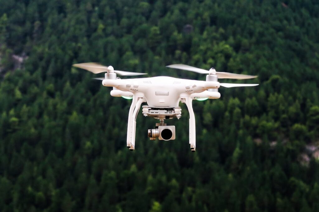
The best drone with infrared camera for civilian and residential inspection work depends on use case rather than a single product ranking. The category includes dual-payload UAVs from several established manufacturers, each with different combinations of sensor resolution, flight time, payload options, and price. This guide covers the category landscape, the Part 107 operating context, and the specifications that actually matter for residential inspection work. It does not promote any single brand and does not link to any manufacturer site.
What the best drone with infrared camera category includes
The category of dual-payload UAVs with thermal imaging includes products from several established manufacturers serving commercial inspection markets. DJI Mavic 3T, Autel EVO II Dual, and Parrot ANAFI USA represent three of the more widely deployed platforms in U.S. commercial use. Each combines a visual camera, a long-wave infrared thermal sensor, and a flight platform sized for portable single-operator deployment. Pricing in the category typically runs from 3,000 to 8,000 dollars for the base platform, with accessories and software adding to total cost.
Several specifications determine practical inspection value. Thermal sensor resolution, commonly 320 by 256 or 640 by 512 pixels, affects detail visible at typical flight altitudes of 50 to 150 feet. Thermal sensitivity, expressed as Noise Equivalent Temperature Difference (NETD), commonly ranges from 30 to 50 millikelvin. Radiometric capability, which allows quantitative temperature data at every pixel, is essential for inspection-grade work. Flight time per battery, typically 30 to 45 minutes, affects coverage on larger properties. Visual camera resolution, often 48 megapixels or higher, supports detailed visual documentation alongside thermal imagery.
Specifications that actually matter
Three specifications matter most for residential and small-commercial inspection work. Thermal resolution at 640 by 512 produces meaningfully more detail than 320 by 256 at the same altitude. NETD at or below 50 millikelvin produces useful contrast for typical residential temperature anomalies. Radiometric output is mandatory for inspection-grade reporting; non-radiometric thermal imagery is essentially surveillance-grade and limits post-flight analysis. Beyond these, flight time and visual resolution affect efficiency and reporting quality rather than core inspection capability.
Other specifications matter less for typical residential work. High frame rates, useful for video surveillance, add little for static building inspection. Specialized payloads such as gas sensors or LIDAR are applicable to specific commercial markets but not to standard residential inspection. Software ecosystem matters during post-flight analysis; major thermal analysis platforms support imagery from the leading manufacturers, but exotic equipment can constrain analysis options.
Why thermal resolution matters at altitude
Thermal resolution interacts with flight altitude to determine the smallest feature visible in the imagery. At 50 feet above a roof surface, a 640 by 512 sensor with a typical lens covers an area where each pixel represents roughly an inch of surface. At 150 feet, that scales to roughly three inches per pixel. A 320 by 256 sensor doubles the per-pixel ground sample, reducing detail by the same factor. For locating small moisture patches or insulation gaps, higher resolution produces meaningfully better inspection data.
FAA Part 107 context for civilian operators
Commercial use of any drone with infrared payload in the United States requires the operator to hold a current Federal Aviation Administration Part 107 Remote Pilot Certificate. The certificate requires passing a knowledge exam covering airspace, weather, regulations, performance, emergency procedures, crew coordination, radio communication, and physiological factors. The certificate is valid for two years before recurrent training is required.
Part 107 imposes operating restrictions that apply regardless of equipment cost or operator experience. Drones may not fly above 400 feet above ground level except within 400 feet of a structure. Flights must remain within visual line of sight of the remote pilot. Operations over people without a Part 107 waiver have specific category requirements based on drone weight and design. Operations in controlled airspace require authorization through the FAA Low Altitude Authorization and Notification Capability (LAANC) system, which is typically obtained through a mobile app within minutes for low-altitude residential work.
Why Part 107 matters for buying decisions
Part 107 affects buying decisions because operating a drone with infrared camera for paid work without certification is outside FAA regulations. Equipment costs are a real expense, but the operator credential is the actual baseline. Homeowners who hire drone thermal inspection services should ask for the operator’s certificate number and verify it through FAA channels before booking work. The certificate is the equivalent of asking a contractor for their state license.
Category leaders in the U.S. commercial market
Three platforms appear most often in U.S. commercial inspection work as of 2026. The DJI Mavic 3T offers 640 by 512 thermal resolution and a 48 megapixel visual camera in a foldable form factor with around 45 minutes of flight time. The Autel EVO II Dual variants offer similar thermal resolution with 8K visual imagery and slightly longer flight time. The Parrot ANAFI USA, designed for U.S. government and enterprise markets, offers 320 by 256 thermal resolution with 4K visual capability and U.S. data handling. Each platform has trade-offs in price, software ecosystem, and certification context.
Several other platforms serve specialized markets. Skydio offers autonomous flight capability that simplifies certain inspection workflows. Higher-end DJI Matrice platforms support payload swapping and larger sensors at proportional cost. Build-your-own platforms based on open-source flight controllers serve specialized commercial markets but are rarely the right fit for a residential inspection business. The category leaders cover most residential and small-commercial use cases without venturing into specialized equipment.
Total cost of operation
Total cost of operating a drone with infrared camera for residential inspection includes more than the initial platform purchase. The Part 107 knowledge exam costs around 175 dollars, with recurrent training every two years. Liability insurance through a specialized drone-operator policy typically runs 600 to 1,500 dollars per year for residential inspection work. Thermal analysis software licenses run 300 to 1,200 dollars per year depending on platform. Battery replacement, propeller replacement, and other consumables add 200 to 500 dollars per year for typical use.
Total first-year operating cost on a base 4,000-dollar platform commonly lands between 6,000 and 8,000 dollars when all these inputs are included. Subsequent years drop to 1,500 to 3,000 in operating cost, plus any equipment replacement. These numbers shape the pricing of professional drone thermal inspection services, which need to recover this overhead over their annual project volume.
Use cases that justify the investment
Several use cases justify the investment in a drone with infrared camera. Home inspection businesses serving Front Range properties with extensive roof areas, where ladder-based inspection takes excessive time. Energy audit firms producing detailed building envelope assessments. Insurance adjusters documenting hail damage and roof condition after weather events. Real estate professionals adding aerial inspection to high-value listings. Roofing contractors documenting pre-installation conditions and post-installation completion.
Residential homeowners almost never justify ownership of inspection-grade drone thermal equipment for personal use. The Part 107 overhead, insurance, software, and equipment cost is rarely recoverable through a handful of personal inspections. Renting or hiring a Part 107-certified service for occasional residential needs is generally the more economical path.
Hiring versus owning
The hire-versus-own decision turns on annual usage. A home inspection business performing 50 or more aerial inspections per year usually justifies ownership through reduced per-project cost. A business performing fewer than 20 aerial inspections per year usually finds subcontracting or partner referrals more cost-effective. Residential homeowners almost always benefit from hiring rather than owning.
For residential buyers considering a one-time drone thermal inspection on a property with significant roof area or large building envelope, hiring a Part 107-certified service typically costs 250 to 700 dollars on the Front Range. That is dramatically less than ownership overhead for a single inspection. The broader home inspection tools hub covers the tool-by-tool decision framework in plain language.
What to look for when hiring a service
When hiring a drone thermal inspection service, several factors distinguish credible operators. Current Part 107 certification with a verifiable certificate number. Liability insurance documentation. Radiometric thermal equipment producing quantitative temperature data rather than just colored imagery. A written reporting deliverable with annotated images and interpretation, not just raw thermal photos. Coordination with ground-based inspection for areas identified as warranting follow-up. Local familiarity with Front Range weather patterns that affect thermal contrast and flight conditions.
Common residential inspection applications
Several residential applications produce useful information from drone thermal work. Roof moisture mapping identifies areas where decking is wetter than surrounding material, indicating possible leaks or trapped moisture. Skylight and chimney thermal scanning identifies flashing failures and condensation patterns. Solar panel installations show thermal anomalies indicating panel defects or hot spots. Attic insulation patterns become visible through ceiling temperature differentials. Window-frame thermal performance shows up as cold or hot edges relative to wall surfaces.
Each application has limits. Drone thermal imaging is a surface-temperature technology; it does not see through materials. The interpretation step translates surface patterns into likely underlying conditions, and that interpretation requires training. Our how does thermal imaging work guide covers the underlying physics. Residential drone thermal work usually pairs best with ground-based handheld thermal imaging and moisture meters for confirmation.
Weather and seasonal timing
Weather constraints shape when drone thermal imagery produces useful data. Thermal contrast depends on temperature differentials between surfaces of different thermal properties. Contrast is greatest in early morning after a clear cold night or in late afternoon after a sunny day. Cloudy weather and stable temperatures reduce contrast. Rain and high winds make drone operation unsafe and prevent flight altogether. Front Range conditions in late fall and early spring often provide the best combination of clear weather and meaningful diurnal temperature swings for thermal inspection.
Snow cover affects roof thermal imaging in complex ways. Uniform snow cover masks thermal differences in the roof surface. Patchy snow melt can indicate underlying thermal anomalies but is difficult to interpret reliably. Most drone thermal inspection happens on snow-free roofs, which constrains scheduling in the high country and at higher elevations during winter months. Lower-elevation Denver metro work is typically possible year-round on snow-free days.
When drone thermal is not the right tool
Drone thermal is not the right tool for interior inspection of walls, ceilings, and crawlspaces; handheld thermal imaging serves those applications. It is not the right tool for quantitative moisture measurement; moisture meters serve that need. It is not the right tool for HVAC ductwork inspection from the inside; specialized scopes serve that purpose. It is also not the right tool for small or simple residential properties where ladder-based visual inspection is faster and cheaper than drone deployment.
The right framing for drone thermal is a screening tool that identifies areas warranting ground-based follow-up. A complete inspection typically includes drone thermal where appropriate, handheld thermal imaging for interior surfaces, moisture meters for quantitative measurement, and visual inspection by a credentialed inspector. The technology supplements rather than substitutes for the rest of the toolkit.
References
- OSHA Aircraft Operations Guidance — Occupational Safety and Health Administration
- InterNACHI Infrared Inspection Standards — International Association of Certified Home Inspectors
- DOE Thermographic Inspections Guide — U.S. Department of Energy
- ASHRAE Building Envelope Standards — ASHRAE
Homeowners in the Denver metro who want help interpreting drone thermal reports or identifying a credentialed local service can reach out through our contact page.
Thermal imaging cameras
Infrared cameras reveal hidden moisture, missing insulation, and air leaks. Phone-attachment models are the budget entry point; standalone units have higher resolution.
| Product | Why | Buy |
|---|---|---|
 FLIR ONE Pro (phone) FLIR ONE Pro (phone) | Plugs into iPhone/Android; inspector favorite. | Amazon — $329.00 |
 Topdon TC001 Topdon TC001 | High-res phone module at a low price. | Amazon — $199.99 |
 FLIR C5 Compact FLIR C5 Compact | Standalone pocket camera with Wi-Fi. | Amazon — $610.06 |