DJI Mavic Thermal Camera: What Homeowners Need to Know
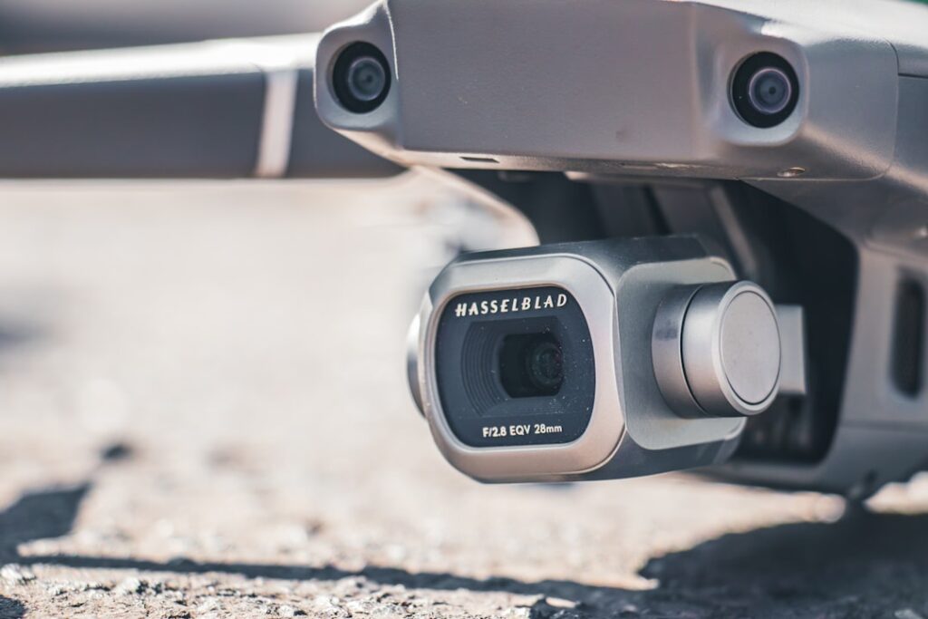
The DJI Mavic thermal camera category is no longer a single product. DJI has produced thermal-equipped Mavic-line drones across three generations and several professional-tier extensions, each with different capability, payload integration, and licensing implications. This guide compares the meaningful options that homeowners and inspectors actually encounter: the Mavic 2 Enterprise Dual, the Mavic 3T, and the larger Matrice 30T which positions just beyond the Mavic family but is the natural step up. The angle is a decision matrix across use cases rather than a feature recitation. None of the recommendations below cite specific manufacturers as authoritative; for tool standards we route to energy.gov, ASHRAE, InterNACHI, and ICC publications.
The Three Thermal Mavic Options at a Glance
The Mavic line and its immediate professional extension covers a wide range of capability.
Mavic 2 Enterprise Dual
The earliest thermal Mavic that became widely available to inspectors. Thermal sensor is modest by current standards, side-by-side visible-light camera produces dual-image capture. Now an older platform with limited DJI software support going forward but plentiful on the used market at attractive prices. Suitable for inspectors evaluating whether thermal drone work fits their service offering before committing to current-generation equipment.
Mavic 3T
The current Mavic-line thermal flagship. Higher thermal resolution than the Mavic 2 Enterprise Dual, better visible-light camera, longer flight time, and current DJI software support including Pilot 2 ecosystem. The Mavic 3T is the practical choice for inspectors who want thermal drone capability in the Mavic form factor with current support.
Matrice 30T
A step beyond Mavic into the Matrice professional line. Significantly larger payload bay, integrated visible-light, thermal, and laser rangefinder, IP55 weather rating, and flight time appropriate for commercial inspection work. Substantially more expensive than the Mavic 3T but the capability gap is meaningful for inspectors handling commercial work, larger residential properties, or any operation where weather windows and flight time matter.
Use Case Decision Matrix
Different inspection scenarios fit different drones better.
Single Residential Property, Roof and Envelope
The Mavic 3T is the practical fit. Thermal resolution is sufficient for identifying roof leaks during the temperature differential window, insulation gaps in eaves, and air leakage at fascia transitions. Flight time covers a typical residential roof inspection comfortably. For inspectors doing this work occasionally, the Mavic 2 Enterprise Dual remains usable, particularly at used-market pricing.
Multiple Residential Properties Per Day
The Mavic 3T’s longer flight time and faster setup reduces the time per property compared to the older platform. Battery rotation between properties is more practical with current-generation batteries.
Commercial or Large Residential
The Matrice 30T’s payload, weather rating, and flight time become decisive. Commercial buildings have larger thermal scan areas, commercial inspections have stricter documentation requirements, and weather windows for commercial work are less forgiving. The cost difference is real but the use-case fit is meaningfully better.
Initial Evaluation Before Service Commitment
The Mavic 2 Enterprise Dual on the used market lets an inspector evaluate whether thermal drone work fits their service offering at lower capital outlay. If the workflow proves valuable, upgrade to current generation. If it does not, the resale market for the platform remains reasonable.
Thermal Resolution and What It Means
The Mavic 2 Enterprise Dual carries a 160×120 thermal sensor. The Mavic 3T carries a 640×512 thermal sensor. The Matrice 30T carries similar thermal resolution to the 3T but with longer-range optics. The resolution difference matters in two ways. First, the detail visible in any given image is dramatically better at higher resolution. Second, the altitude at which usable thermal data is captured increases with resolution, meaning higher-resolution drones can scan larger areas in less time. For inspectors moving from the Mavic 2 Enterprise Dual to the Mavic 3T the resolution upgrade is substantial.
Licensing and Regulatory Considerations
Commercial use of any of these drones in the United States requires Part 107 certification under FAA regulations. Inspectors using drones as part of paid services should hold a current Part 107 certificate. Recreational use under the Recreational UAS Safety Test (TRUST) framework applies to non-commercial flights. State and local restrictions sometimes apply, particularly near airports, military installations, and wildlife preserves. Insurance for commercial drone operation is typically purchased separately from general business liability.
Workflow Integration With Ground-Based Tools
Thermal drone work supplements, not replaces, ground-based inspection. The drone identifies suspect areas on roofs and envelopes that are hard to access. Ground-based moisture meters, borescopes, and visual inspection confirm what the thermal anomaly actually represents. Working inspectors typically use the drone as a survey tool that identifies where deeper investigation is warranted. Our companion article on the DJI Mavic 3 thermal camera commercial bundle covers integration with reporting software.
Software Ecosystem Differences
DJI’s Pilot 2 software supports current-generation drones including the Mavic 3T and Matrice 30T. The Mavic 2 Enterprise Dual uses the older Pilot app, still functional but with diminishing update support. For inspectors building thermal drone work into a regular service offering, current-generation software matters because reporting integration, flight planning, and data export tools evolve with the software. Third-party reporting platforms integrate at varying levels with each generation.
Cost Considerations
Mavic 2 Enterprise Dual used pricing has dropped substantially as the platform aged. Mavic 3T new pricing approaches mid-five-figure territory when including spare batteries, cases, and licensing fees. Matrice 30T pushes well into five-figure territory and is genuinely a commercial-equipment investment. Inspectors should match the drone tier to expected service revenue rather than buying the most capable platform out of aspiration. Homeowners researching the broader category can read our DJI drone with thermal camera lineup guide alongside the home inspection tools buyer’s guide for context on how thermal drones fit into a complete inspection kit.
Front Range Operating Considerations
Colorado conditions affect thermal drone work in specific ways. Front Range winds frequently exceed comfortable flying conditions for the lighter Mavic-class drones. The Matrice 30T’s heavier airframe handles wind better, which matters on a service where weather windows determine whether inspections can complete on schedule. Snow and ice conditions on roofs add visible-light contrast that improves thermal interpretation. Summer afternoon thunderstorms compress the usable flight window on most days. Inspectors planning service availability around weather should account for these patterns.
Comparison Summary
The decision factors that matter most.
Budget
Used Mavic 2 Enterprise Dual: lowest. New Mavic 3T: mid. Matrice 30T: highest. Match to service revenue.
Thermal Resolution
Mavic 2 Enterprise Dual: lowest. Mavic 3T and Matrice 30T: similar at the current top tier.
Flight Time
Mavic 2 Enterprise Dual: adequate. Mavic 3T: better. Matrice 30T: best.
Weather Tolerance
Mavic 2 Enterprise Dual and 3T: similar Mavic-class. Matrice 30T: IP55 rated, substantially better.
Software Support
Mavic 2 Enterprise Dual: diminishing. Mavic 3T and Matrice 30T: current.
Use Case Fit
Mavic 2 Enterprise Dual for evaluation and occasional use. Mavic 3T for regular residential service. Matrice 30T for commercial and larger residential.
When to Stay Ground-Based Instead
Not every inspection benefits from drone work. Single-story homes with safely accessible roofs may not justify the time to set up and fly. Steep-pitched, walkable roofs can be inspected efficiently from the ridge. Properties with restricted airspace, dense tree cover, or unstable weather may not allow flight on the scheduled day. The drone is a tool that fits some scenarios better than others.
Setting Up Thermal Drone Work as a Service
Inspectors adding thermal drone capability to their service offering navigate a few setup considerations beyond the drone itself. FAA Part 107 certification and recurrent training every two years. Commercial drone liability insurance, typically purchased separately from general business liability. Reporting software that integrates aerial thermal imagery alongside ground-based findings. A field workflow that includes pre-flight checklist, flight planning for the specific property, post-flight image review on site to confirm coverage, and report generation back at the office. Each of these takes time to set up but produces a repeatable workflow that scales.
Flight Planning Considerations for Residential Inspections
A residential roof scan typically takes 15 to 30 minutes of flight time including hover-and-capture passes. Pre-flight planning identifies airspace restrictions, nearby obstacles, takeoff and landing zones, and the specific image-capture pattern that will cover the roof and envelope. DJI’s Pilot 2 software supports flight planning on current-generation drones. The Mavic 2 Enterprise Dual uses the older Pilot app with similar capability at lower polish. Mission planning during the office prep phase saves time on site.
Image Processing Workflow
Raw thermal images from any DJI thermal drone require processing to produce useful inspection deliverables. DJI Thermal Analysis Tool reads the embedded radiometric data and allows temperature measurement at specific points, area analysis, and image annotation. Third-party tools like FLIR Tools (compatible with some DJI imagery via export) offer additional processing options. Working inspectors standardize on one workflow and stick with it; switching between tools mid-job complicates reporting.
Common Findings That Justify Aerial Thermal
The findings that thermal drone scanning surfaces that ground inspection might miss: heat loss through roof penetrations and vents that are hard to see from the ground, missing insulation in attic areas not accessible during the inspection, ice-dam-prone roof areas that show thermal patterns even without active dam formation, and moisture-affected roof decking where the thermal signature reveals what the visible surface conceals. Each of these has its own typical pattern in the thermal imagery that experienced operators learn to recognize.
The Learning Curve for New Operators
Acquiring proficiency with a thermal drone takes more time than acquiring the drone itself. Pilots new to thermal interpretation often miss findings that experienced operators catch easily, and conversely sometimes flag normal thermal patterns as problems. InterNACHI’s thermography certification curriculum, manufacturer training programs, and supervised flight time with experienced operators all accelerate the learning curve. Inspectors adding thermal drone work to their service offering benefit from building proficiency on their own properties or training scenarios before charging for the work on client properties.
Storage and Transport of the Drone System
Thermal drones are sensitive instruments that benefit from careful storage and transport. Hard cases sized for the specific drone with foam cutouts for the airframe, batteries, controller, and accessories protect against transport damage. Battery storage at room temperature with regular discharge cycles preserves capacity. Avoiding extreme temperatures during transport prevents thermal sensor damage. Working inspectors who carry their drone system in a service vehicle face Colorado summer cabin temperatures that can exceed manufacturer storage limits; insulated storage bins or in-vehicle climate management protects the equipment.
References
- Department of Energy: Thermographic Inspections — energy.gov
- InterNACHI: Infrared Certification — International Association of Certified Home Inspectors
- ASHRAE: Standards and Guidelines — American Society of Heating, Refrigerating and Air-Conditioning Engineers
- ASHI: Standards of Practice — American Society of Home Inspectors
Thermal imaging cameras
Infrared cameras reveal hidden moisture, missing insulation, and air leaks. Phone-attachment models are the budget entry point; standalone units have higher resolution.
| Product | Why | Buy |
|---|---|---|
 FLIR ONE Pro (phone) FLIR ONE Pro (phone) | Plugs into iPhone/Android; inspector favorite. | Amazon — $329.00 |
 Topdon TC001 Topdon TC001 | High-res phone module at a low price. | Amazon — $199.99 |
 FLIR C5 Compact FLIR C5 Compact | Standalone pocket camera with Wi-Fi. | Amazon — $610.06 |